Recounting my experience on my out & back thru hike of the Escarpment Trail in the Catskill Mountains of New York.
Kaaterskill Falls Parking Lot on Laurel House Road to North Point Campsite -- 8.0 miles
I found the overflowing parking lot at the end of Laurel House Road quite overwhelming. Since I was going to be leaving my car for multiple days, I didn't want to just "stuff" it into a random space, but an actual parking space. I diligently waited for one to open. This would be just a number of conundrums I would encounter... you see, you can be remarkably close to the trail you want to be on, but getting to that trail can be rather difficult. I found myself wandering for close to 30 minutes attempting to locate the trail-head. I only found it because I saw some people on the other side of a gully (that I picked my way down and back up) and noticed a trail sign with blue coloring, noting the Escarpment Trail.
Once I started, I was giddy to be on a trail that I intended to thru hike. There's just something about hiking a trail to completion; as far as it will go. You can say you saw everything that specific trail has to offer. And so I hiked on. Not too long after joining up with the trail, it took a sharp left and jutted me out onto a ledge that overlooked Haines Falls, NY and the vast drop to the valley below. This cliff-walking invigorated me and I picked up steam.
 |
| Cliff Walking on Day #1 |
After hiking on the ledges, the trail wound inward into the forest and leveled off, leaving me hiking at a good clip and interacting with multiple day hikers that were staying at the nearby North Lake Campground. The trail climbed up to North Point, which overlooks North Lake and it was a stunning display of Catskill beauty. However, I'm now pressed for time, as dusk has settled and I'm looking for the "unofficial" campsite that my guidebook mentions. I don't find it, specifically. I hiked on until I came into a coniferous patch on the trail and saw a spot where others had previously camped before; marked by the notably barren forest floor. I am low on day light, without a water supply, and the Escarpment Trail is infamous for its' lack of water. Since I'm unsure about the water availability in the coming days, I opt to not cook my dinner food (to preserve water), but instead eat my lunch food (tortilla, cheese, and salami) for dinner. I soon fall asleep, as the soft forest floor beneath my tent felt lovely after a long day.
 |
| North Point Ledge Overlook |
Water, Oh Water, Where Art Thou? - Oct. 9th
North Point Campsite to Batavia Kill Lean To -- 8.5 miles
I am woken by the sound of rain on my rain fly and think to myself, that's not good... the forecast I saw before I left mentioned nothing of the sort. I also notice that it is much more windy than I care for it to be and wonder if the hurricane that plagued the Florida coast has made its way up the eastern seaboard... I try to fall back asleep but the wind is circling, screaming through the coniferous pine forest that surrounds me. If you have ever been in a coniferous forest and it is very windy, it makes a distinct sound; unlike the wind blowing through a deciduous forest. I can also hear the wind howling not too far away out on the rim of the Escarpment and I think to myself that I will have a long day, whatever it entails. Pine needles fall scatter-like on my rain fly and with each gust of wind, they get blown off until they build up again and another gust comes along.
It is approaching 10AM before I even think of getting out of my tent and when I do so, I get right back in. I hear some voices from afar around 11AM and I get out once again. I hike the short distance to the North Point overlook and decide that the weather looks to be settling, so I decide to go back and pack up to shoot for Batavia Kill Lean To. My only concern is that I must cross over Blackhead Mountain, a stout 3,940 feet. My guidebook kindly notes that hikers have died crossing this summit in high wind events and also notes how wind is a very prominent weather event on the Escarpment. I know my limitations and assess the weather to be settling. Off I go. Hiking on Day #2 leaves me smiling more than worried. I come across a couple with Korean sheep dogs at Countryman / Winter Clove Overlook as well as come across a plane crash (that happened in May 1983). The plane crash is literally right on the trail and it amazes me that the plane is still as intact as it is for being so accessible.
 |
| "Air Crash #2" |
I soon come to Dutcher Notch and my guidebook suggests that I refill my water here. I go right, to the closest noted water source, and it is bone dry. I hike back to the trail, clocking a wasted 0.4 miles. I can also go left here at the notch, but that water source is further away, but I hike to that noted water source, that is also bone dry. Pissed off that I have now hiked over 1 mile in off-trail miles and have no water to show for it, I pick my way down the dry stream bed in search of a reservoir puddle. I come to one eventually and dunk my bottle down into it, bring back up a bottle full of such brown water that I couldn't see through it. I don't dump it out, as I may have to drink it, but I'm not that desperate... yet.
I go up and over Blackhead and I feel as if I'm back in the White Mountains in New Hampshire; the brutal ascent (and descent) makes my knees and leg muscles quiver. Yet, the trail winds down, losing almost 1,300 feet before coming to the trail junction for Batavia Kill Lean To. Once there, I ask where the water source is and I'm directed to a 2-foot-by-2-foot puddle. The water is cold and clear and I fill up like I never have! It's not a spring, per say, but it seems that whatever is taken from it, gets replenished from below, but it's not a flowing water source, either. I go to sleep relieved that I have fresh water. And this is America...
 |
| Arca Point |
I Can't Feel My Face - Oct. 10th
Batavia Kill Lean To to Windham Highpoint (and back) - 10 miles
It is so cold in the morning that I literally don't want to get out of my sleeping bag, but those miles won't hike themselves!! Once back on the trail, I'm hiking with pants, windbreaker, hat and gloves. You know it's cold when you can hike up and down mountains, weighted down with a pack, and still not generate enough heat to keep you warm... My friend Skyline has been monitoring the weather for me and texts me that freeze warnings were issued for this area. My face agrees.

The trail winds through coniferous patches of forest that are also lined with such freshly-dropped red leaves, it feels as if I'm walking on my own red carpet. Hiker trash red carpet, baby! The climb up to Windham Peak is slow and steady but it dragged on, in my mind. Once there, there were a few overlooks but I'm surprised that I've not gone over a barren summit that provides 360-degree views. I appreciate the variety of different overlook spots, but nothing compares to a 360-degree view! I make lunch, using my pot lid that doubles as a frying pan and make "grilled" tortillas with cheese and salami.
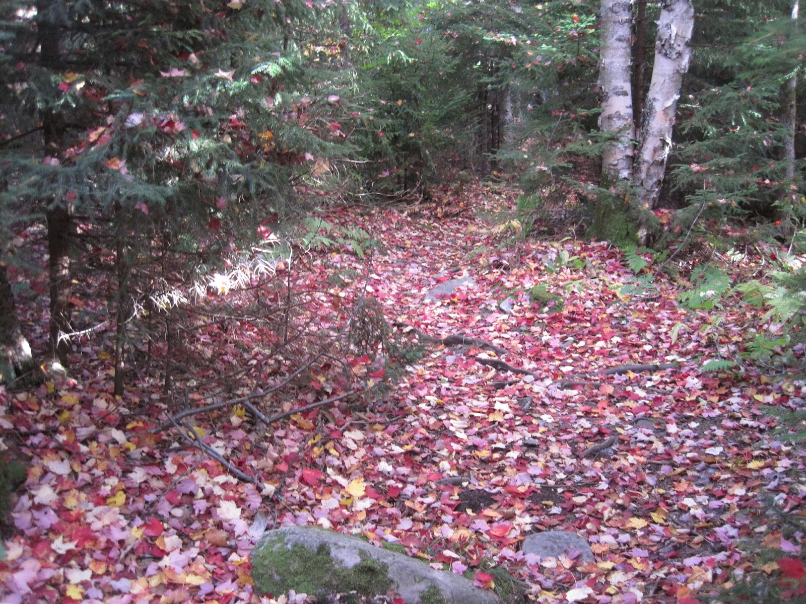 |
| Hiker Trash Red Carpet |
I reverse my direction after lunch, heading back towards Batavia Kill Lean To. I opt to not go down to the end of the trail. Doing this would lose me more than 1,000 feet in elevation and I would have to climb right back up it. Terminating my initial direction on a summit seemed like something more enjoyable. I camp by myself at the Batavia site, which is noticeably vacant, compared to just an evening ago.
Perfect Hiking - Oct. 11th
Batavia Kill Lean To to Kaaterskill Falls Parking Lot - 16.0 miles
I awake and feel the cold morning air but the wind is noticeably gone and the forest is quiet. I take my time packing up in the morning but my spirits are high and the weather couldn't be better. I hike back up Blackhead Mountain, gaining over 1,200 feet and the summit is much more inviting than two days ago. I'm glad that I'm doing an out and back because the weather the first two days was kinda crummy. I can now see all those overlooks in all their glory! I linger, taking photos and enjoying the precarious viewpoint on the summit... it feels like I could jump off and not land until I hit the valley floor below, some 2,000 feet below.
 |
| Blackhead Mountain |
I hike on, with plenty of water, thanks to the self-resupplying puddle at Batavia. I don't see many other people for most of the day until I wind my way back to North Lake Campground, where there are still numerous day hikers. I imagine that this campground fills up quickly no matter the day during fall foliage season. I take a side trail to Bear's Den and this overlook is said to be the best in the Catskills! I think they might be right...
 |
| Bear's Den overlooking North Lake |
I come to the ledge walk section towards the end/beginning of my hike and the weather couldn't be more perfect. The overlook is aptly named Sunset Rock and the sun will set in about 45 minutes. I decide to wait for it, seeing as how I blazed through 16 miles today. It was beautiful.
 |
| Sunset from Sunset Rock |
A wonderful adventure with a lot of variety! The pics and the colors are magnificent. Isn't fall great? Being the concerned person I am, :) I didn't like the sound of hikers being blown away or no water but I'm glad you enjoy the big outdoors. On to your next adventure!! May there be many. Luvs!
ReplyDeleteA fantastic four days in the northern mountains. I'm jealous I couldn't be there too! You suffered more than you let on, I think, but you made some smart mature decisions that paid big dividends on your return trek. Kudos! Best wishes on the remainder of a well deserved vacay!
ReplyDeleteLooks like an amazing place in New York. Happy you are doing this hike! Will expect a wildlife sighting report!
ReplyDelete